 eTrex 30
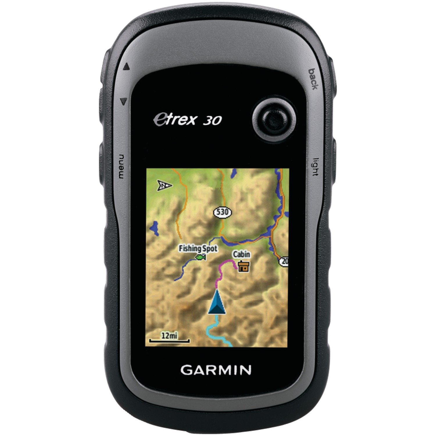
- Worldwide base map
- 2.2″ 65K color, sunlight-readable display
- 3-axis compass and barometric altimeter
- Wireless capability to share waypoints, routes and geo caches with other similar devices
- GPS and GLONASS satellites for faster positioning
eTrex 30 takes one of the most popular and reliable GPS handhelds and makes it better. Enhanced ergonomics, an improved interface, paperless geo caching and expanded mapping capabilities makes eTrex more versatile and user-friendly, while maintaining its toughness and durability.
Technical Specification
Physical & Performance: Physical dimensions 2.1″ x 4.0″ x 1.3″ (5.4 x 10.3 x 3.3 cm) Display size, WxH 1.4″ x 1.7″ (3.5 x 4.4 cm); 2.2″ diag (5.6 cm) Display resolution, WxH 176 x 220 pixels Display type Trans flective, 65-K color TFT Weight 5 oz (141.7 g) with batteries Battery 2 AA batteries (not included); NiMH or Lithium recommended Battery life 25 hours Water rating IPX7 Floats No High-sensitivity receiver Yes Interface USB Maps & Memory: Base map Yes Preloaded maps no Ability to add maps Yes Built-in memory 1.7 GB Accepts data cards Micro SD™ card (not included) Waypoints/favorites/locations 2000 Routes 200 Track log 10,000 points, 200 saved tracks Features & Benefits: Automatic routing (turn by turn routing on roads) Yes (with optional mapping for detailed roads) Electronic compass Yes (tilt-compensated 3-axis) Touch screen No Barometric altimeter Yes Camera no Geo caching-friendly Yes (Paperless) Custom maps compatible Yes Photo navigation (navigate to geotagged photos) Yes Hunt/fish calendar Yes Sun and moon information Yes Tide tables Yes (with optional Blue chart) Area calculation Yes Custom POIs (ability to add additional points of interest) Yes Unit-to-unit transfer (shares data wirelessly with similar units) Yes Picture viewer Yes Garmin Connect™ compatible (online community where you analyze, categorize and share data) Yes 
- Download Product Details